Contributed by rkohler3 on 1/27/20 - Image Year: 2011
COVER PHOTO: View of Port Royal taken for the cover of the Bicentennial History "Perrysville to Port Royal - A 200 Year History" (Photo courtesy of Wayne Taylor)
Contributed by rkohler3 on 3/1/13 - Image Year: 2012
LOOKING NORTHWARD TOWARD MIFFLIN AND MIFFLINTOWN: (Photo submitted by Wayne Taylor)
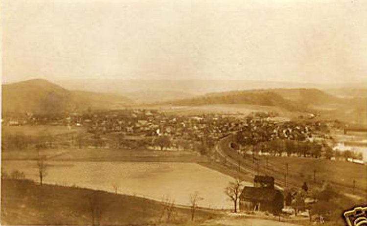
Contributed by ray on 3/28/18 - Image Year: 1900
PORT ROYAL FROM ROUNDTOP: A view of Port Royal from atop Roundtop just across the Tuscarora Creek in Turbett Township (south of Old Port).
Contributed by rkohler3 on 11/20/09 - Image Year: 1900
PORT ROYAL FROM ROUNDTOP: A view of Port Royal from atop Roundtop just across the Tuscarora Creek in Turbett Township (south of Old Port).
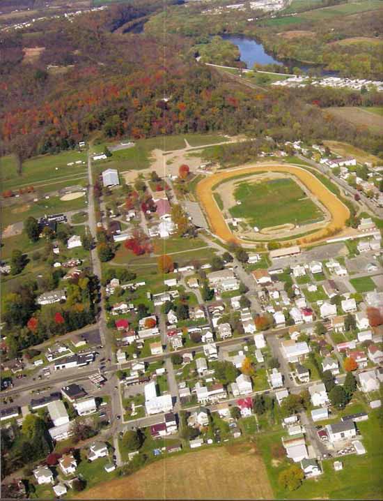
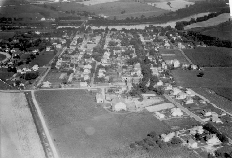
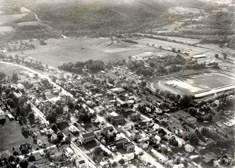
Contributed by rkohler3 on 9/18/09 - Image Year: 1930
Town Lane can be seen running diagonally into the bottom right hand corner. Moyer Farm is on the right hand side in the center. No houses have been built on Milford Street beyond Eighth. The covered bridge spans the Juniata River in line with Milford Street. The southern turn of the race track is visible at the left side. Running down Milford Street are the tracks of the Tuscarora Valley "TV" Railroad that branch off to the left about 3rd Street.
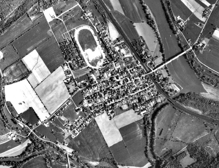
Contributed by rkohler3 on 10/26/09 - Image Year: 1938
This picture shows an aerial view of Port Royal taken on September 25, 1938. You can see that there are no houses on Milford Street beyond Eighth Street. In fact most of the northern side of Milford Street remains undeveloped. Also, Town Lane has been only partially developed. The Moyer and Groninger Farms are still to be developed.
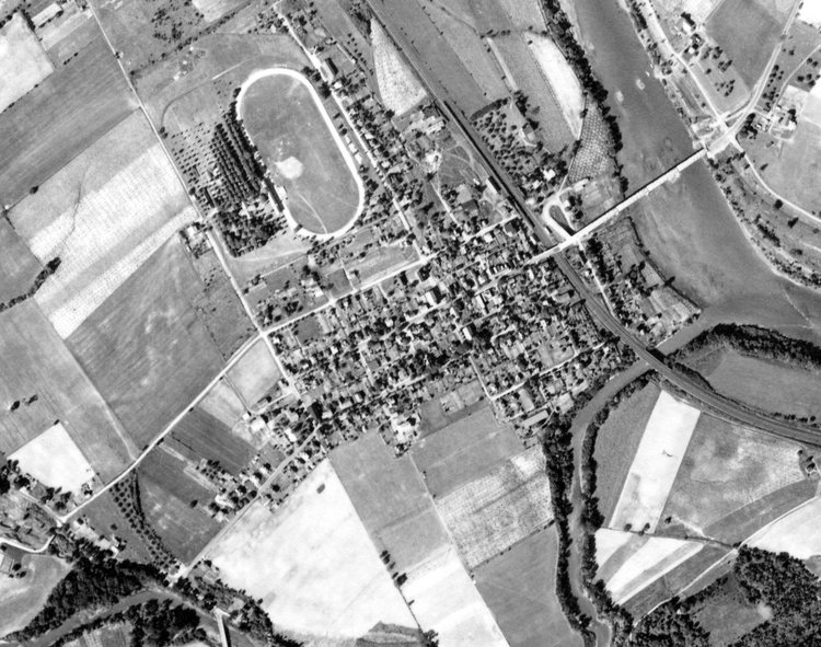
Contributed by rkohler3 on 10/26/09 - Image Year: 1957
This photo was taken May 8, 1957. The southern side of Milford has been developed beyond Eighth Street but not the northern side. The Moyer Farm still remains undeveloped. The Point Service Station remains at the western end of Market Street and the extension of the road from Market to the Old Port Bridge still hasn't occurred.
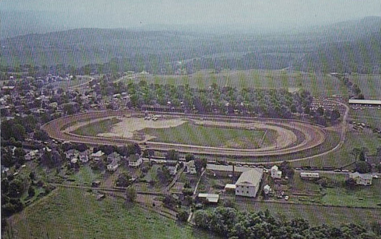
Contributed by rkohler3 on 12/24/10 - Image Year: 1960
A VIEW OF PORT ROYAL FROM THE NORTH: The Race Track is prominent in the picture with much of the town stretching south of it. (Photo about 1960.)
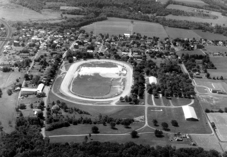
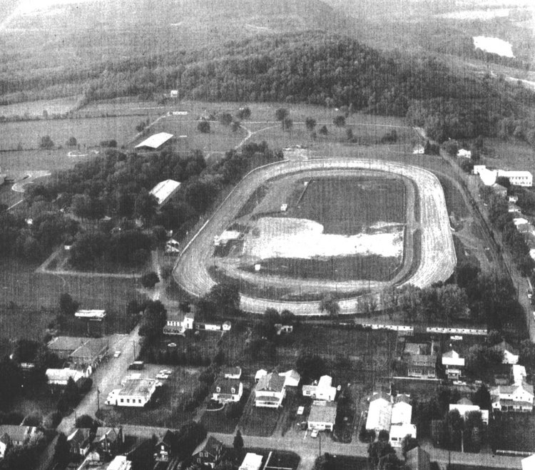
Contributed by rkohler3 on 9/18/09 - Image Year: 1969
This photo focuses on the Port Royal Fairgrounds and Speedway. Fairview (West Fourth Street can be seen at the right of the picture, while Sixth Street is visible in the lower left of the photo. (Photo supplied by Sheila Yorks)
Contributed by rkohler3 on 10/26/09 - Image Year: 1970
This photo of Port Royal was taken in 1970. Houses have begun to appear on the northern side of Milford Street beyond Eighth Street. The new Tuscarora Valley Elementary School is visible at the top of Eighth Street opposite the Fair Grounds. Most of Town Lane has been developed. And the road linking Market Street with the Old Port Bridge is in place.
Contributed by rkohler3 on 12/25/10 - Image Year: 1970
Aerial View from the East. It appears that the fair may be in session. Since Route 75 has been modified the photo was taken after 1967 (when Route 75) was rerouted and by 1973 (when the high school building was dismantled).
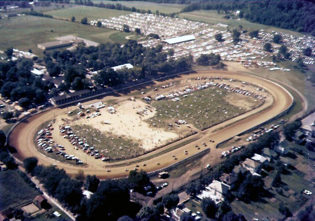
Contributed by rkohler3 on 9/22/09 - Image Year: 1975
Port Royal Speedway during Fair Week and the races.
Contributed by rkohler3 on 8/18/11 - Image Year: 1975
This view shows how Port Royal is surrounded by water. The Tuscarora Creek is clearly visible on the left and bottom of the photo, Just a small portion of the Juniata River can be seen where the Creek flows into the River at the bottom right of the photo.
Contributed by rkohler3 on 9/22/09 - Image Year: 1977
Port Royal Fair Grounds
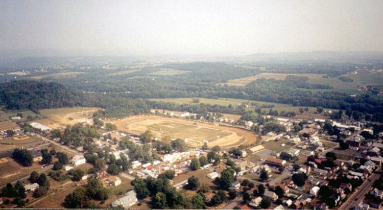
Contributed by rkohler3 on 9/18/09 - Image Year: 1990
In this photo, Market Street can be seen in the lower right of image. The intersection of Milford and Eighth Streets occurs about the center bottom of the picture. The most recognizable image on the photo is the Port Royal Speedway.
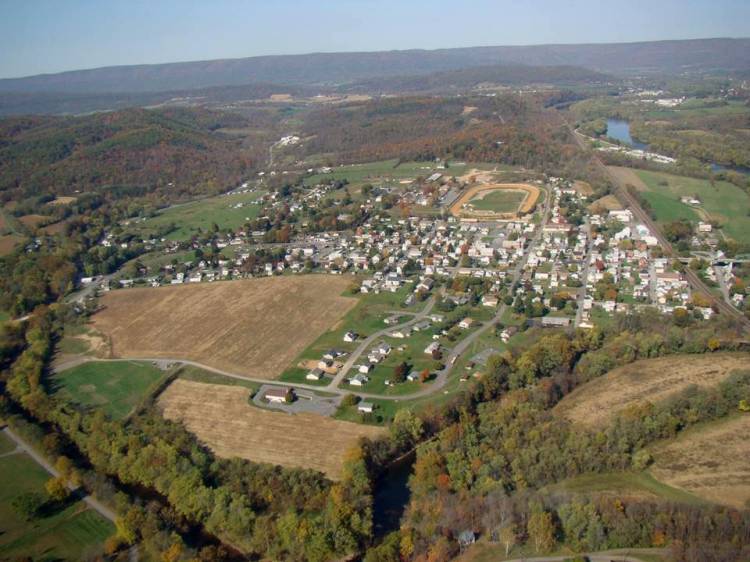
Contributed by rkohler3 on 7/14/11 - Image Year: 2000
Port Royal focused on the Fairgrounds and racetrack.
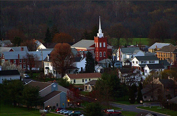
Contributed by rkohler3 on 8/6/11 - Image Year: 2009
Port Royal at dusk. The Lutheran Church is prominent in the center of the photo, while the Faith Bible Church is at the bottom left. (The photo was taken between 2008 and 2011)
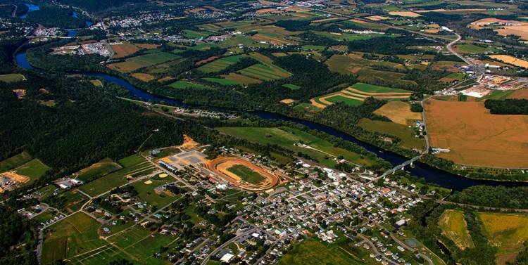
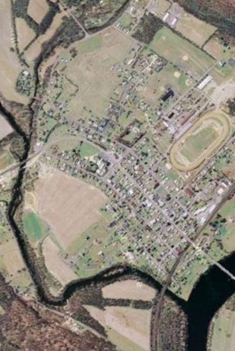
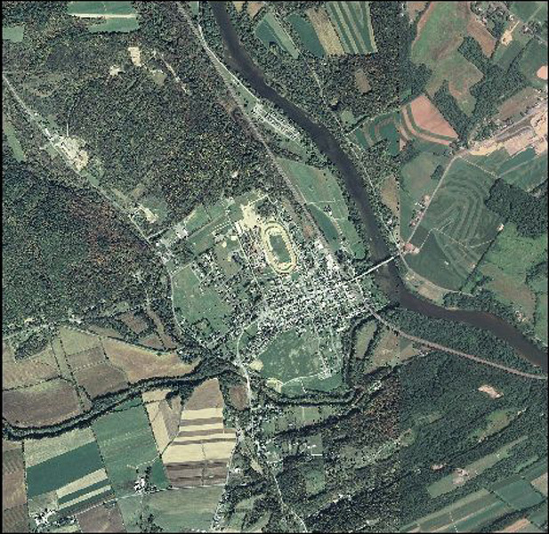
Contributed by ray on 7/15/11 - Image Year: 2010
Port Royal and surrounding townships.
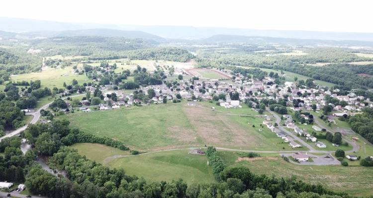
Contributed by rkohler3 on 10/17/21 - Image Year: 2021
AERIAL VIRW OF PORT ROYAL: This view was taken by Harry Summers through use of a drone in the Summer of 2021. (Photo submitted by Wayne Taylor.)
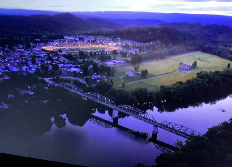
Contributed by rkohler3 on 6/1/22 - Image Year: 2022
Evening Aerial View of Port Royal from south east of the Juniata River Bridge. With the Port Royal Speedway lighted.